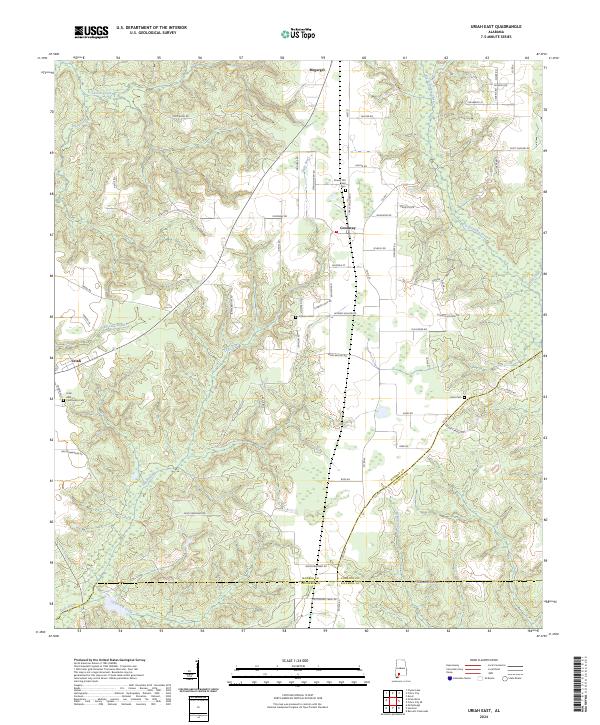
2024 Map of Uriah East
USGS Topo · Published 2024About this map
The borderlands between Monroe, Conecuh, and Escambia counties are defined by a complex network of waterways, with the Little River and Big Escambia Creek carving paths through this part of southern Alabama. Small rural communities like Uriah, Goodway, and Megargel serve as the primary hubs, connected by a dense web of local roads such as Goodway Rd and Neuschwander Rd. Genealogists will find significant value in the documentation of several family and community burial sites, including Sowell Old Field Cem, Enon Cem, and the Uriah Community Cem. The landscape is a quiet mosaic of timberland and agriculture, drained by numerous smaller tributaries like Hurricane Branch, Chitterling Creek, and Lovetts Creek. The intricate terrain is further detailed by named features such as Hickory Hollow Rd and Turkey Hollow Rd, reflecting the localized nomenclature of the area.
Find a feature on this map
74 named features on this map. Tap any name to fly to it.
Don’t see what you’re looking for? This feature index may not catch every label — zoom into the map to look around manually.
Map Details
Editions of this 2024 Uriah East Map
This is the sole edition of this map. No revisions or reprints were ever made.
Other maps of this area

1942 · Perdido
USGS Topo · 1:62,500

1944 · Perdido
USGS Topo · 1:62,500

1953 · Andalusia
USGS Topo · 1:250,000

1957 · Andalusia
USGS Topo · 1:250,000

1960 · Huxford
USGS Topo · 1:24,000

1960 · Barnett Crossroads
USGS Topo · 1:24,000

1972 · Frisco City
USGS Topo · 1:24,000

1972 · Frisco City SE
USGS Topo · 1:24,000

1972 · Uriah East
USGS Topo · 1:24,000

1972 · Excel
USGS Topo · 1:24,000