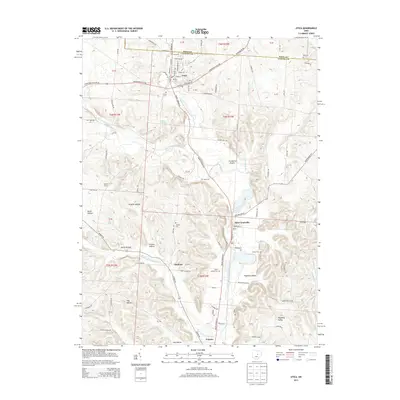
2013 Map of Utica
USGS Topo · Published 2013About this map
Utica sits at the intersection of several regional thoroughfares near the northern boundary between Knox and Licking Counties. This area is defined by the complex branching of the Licking River system, including the North Fork, Clear Fork, and Lake Fork. The landscape is a network of ridges and hollows, such as Preston Hollow and Burse Hollow, that separate small agricultural communities.
Find a feature on this map
65 named features on this map. Tap any name to fly to it.
Don’t see what you’re looking for? This feature index may not catch every label — zoom into the map to look around manually.
Map Details
Editions of this 2013 Utica Map
This is the sole edition of this map. No revisions or reprints were ever made.
Other maps of this area

1908 · Granville
USGS Topo · 1:62,500

1909 · Newark
USGS Topo · 1:62,500

1910 · Granville
USGS Topo · 1:62,500

1912 · Gambier
USGS Topo · 1:62,500

1914 · Gambier
USGS Topo · 1:62,500

1915 · Fredericktown
USGS Topo · 1:62,500

1943 · Gambier
USGS Topo · 1:62,500

1943 · Fredericktown
USGS Topo · 1:62,500

1950 · Marion
USGS Topo · 1:250,000

1961 · Hanover
USGS Topo · 1:24,000