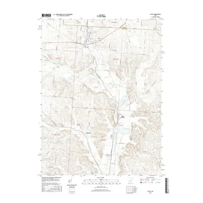
2016 Map of Utica
USGS Topo · Published 2016About this map
Utica sits at the junction of Licking and Knox counties, where the North Fork Licking River carves through the landscape. This 2016 survey highlights the agricultural and residential development patterns surrounding the settlements of Saint Louisville and Chatham. The drainage system is particularly well-defined, featuring numerous tributaries such as Lake Fork Licking River, Clear Fork Licking River, and Simonds Run that feed into the larger river valley. For local historians and genealogists, the map provides precise locations for several burial grounds, including Utica Cem, South Lawn Cem, and Coad Cem, along with church-affiliated sites like Saint Joseph Cem. The presence of several hollows, including Burse Hollow and Preston Hollow, suggests a varied elevation where smaller stream beds have shaped the local topography over time.
Find a feature on this map
105 named features on this map. Tap any name to fly to it.
Don’t see what you’re looking for? This feature index may not catch every label — zoom into the map to look around manually.
Map Details
Editions of this 2016 Utica Map
This is the sole edition of this map. No revisions or reprints were ever made.
Other maps of this area

1908 · Granville
USGS Topo · 1:62,500

1909 · Newark
USGS Topo · 1:62,500

1910 · Granville
USGS Topo · 1:62,500

1912 · Gambier
USGS Topo · 1:62,500

1914 · Gambier
USGS Topo · 1:62,500

1915 · Fredericktown
USGS Topo · 1:62,500

1943 · Gambier
USGS Topo · 1:62,500

1943 · Fredericktown
USGS Topo · 1:62,500

1950 · Marion
USGS Topo · 1:250,000

1961 · Hanover
USGS Topo · 1:24,000