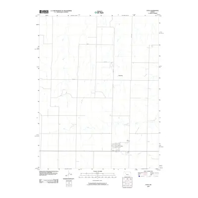
2009 Map of Utica
USGS Topo · Published 2009About this map
The town of Utica serves as the focal point of this Western Kansas landscape, where the organized grid of Stanley St and local avenues meets the vast agricultural plains. This late-2000s survey captures the region's reliance on intermittent water systems, defined by the winding paths of Big Windy Creek and Sand Creek. The rural character of the area is further established by the small settlement of Alanthus to the north and the nearby Utica Cemetery, which provides a vital point of reference for genealogists and local historians researching the community's roots.
Find a feature on this map
13 named features on this map. Tap any name to fly to it.
Don’t see what you’re looking for? This feature index may not catch every label — zoom into the map to look around manually.
Map Details
Editions of this 2009 Utica Map
This is the sole edition of this map. No revisions or reprints were ever made.
Other maps of this area

1955 · Scott City
USGS Topo · 1:250,000

1958 · Scott City
USGS Topo · 1:250,000

1965 · Utica SW
USGS Topo · 1:24,000

1966 · Utica SE
USGS Topo · 1:24,000

1974 · Gove SE
USGS Topo · 1:24,000

1974 · Castle Rock
USGS Topo · 1:24,000
1974 · Gibson Creek
USGS Topo · 1:24,000

1974 · Pendennis
USGS Topo · 1:24,000

1974 · Shields SE
USGS Topo · 1:24,000
1981 · Arnold
USGS Topo · 1:24,000