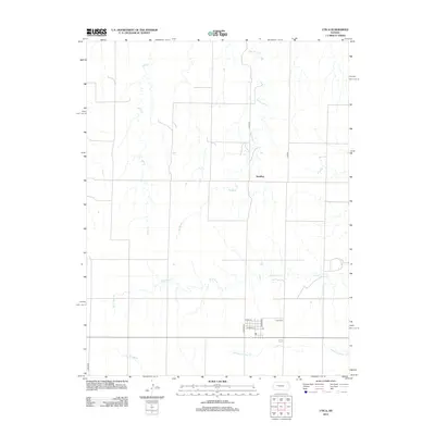
2012 Map of Utica
USGS Topo · Published 2012About this map
Utica sits at the southern edge of this West Central Kansas landscape, where the High Plains are etched by a network of drainage systems. The town’s layout is defined by streets such as W Bell St and Jackson Ave, with the Po and Utica Cem serving as central community points. North of the settlement, the terrain transitions into a series of creek beds, including the winding course of Big Windy Cr and the intermittent flows of Sand Cr and Wild Horse Cr. The small community of Alanthus appears as a rural node along these waterways, illustrating the sparse settlement pattern characteristic of the region. The boundary between Lane and Ness counties bisects the southwestern corner of the map, while N Fork Forrester Cr and Cold Springs Br flow through the southern reaches, highlighting the vital role of water in this semi-arid environment.
Find a feature on this map
16 named features on this map. Tap any name to fly to it.
Don’t see what you’re looking for? This feature index may not catch every label — zoom into the map to look around manually.
Map Details
Editions of this 2012 Utica Map
This is the sole edition of this map. No revisions or reprints were ever made.
Other maps of this area

1955 · Scott City
USGS Topo · 1:250,000

1958 · Scott City
USGS Topo · 1:250,000

1965 · Utica SW
USGS Topo · 1:24,000

1966 · Utica SE
USGS Topo · 1:24,000

1974 · Gove SE
USGS Topo · 1:24,000

1974 · Castle Rock
USGS Topo · 1:24,000
1974 · Gibson Creek
USGS Topo · 1:24,000

1974 · Pendennis
USGS Topo · 1:24,000

1974 · Shields SE
USGS Topo · 1:24,000
1981 · Arnold
USGS Topo · 1:24,000