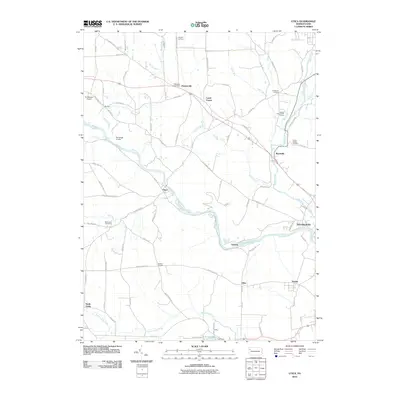
2010 Map of Utica
USGS Topo · Published 2010About this map
French Creek winds through the heart of this Venango County landscape, passing the borough of Utica and the community of Takitezy. The map reveals a network of small settlements and family-named corners typical of western Pennsylvania, including Hannasville, Wyattville, and McKenzie Corners. To the north, Canal Center sits near the crossing of Old Route 322, while the southern reaches feature Polk Dam Lake and the village of Niles. Local history and genealogy are well-represented by several burial sites, such as Millcreek Cemetery, Oakwood Cemetery, and Forest Chapel Cemetery. Aviation and recreation also shape the modern landscape, evidenced by the Port Roydel Airport in the northwest and Sleepy Hollow Golf Course near the banks of Sugar Creek in the northeast.
Find a feature on this map
83 named features on this map. Tap any name to fly to it.
Don’t see what you’re looking for? This feature index may not catch every label — zoom into the map to look around manually.
Map Details
Editions of this 2010 Utica Map
This is the sole edition of this map. No revisions or reprints were ever made.
Other maps of this area

1909 · Franklin
USGS Topo · 1:62,500

1911 · Franklin
USGS Topo · 1:62,500

1911 · Stoneboro
USGS Topo · 1:62,500

1913 · Stoneboro
USGS Topo · 1:62,500

1923 · Meadville
USGS Topo · 1:62,500

1925 · Meadville
USGS Topo · 1:62,500

1927 · Townville
USGS Topo · 1:48,000

1932 · Townville
USGS Topo · 1:62,500

1943 · Meadville
USGS Topo · 1:62,500

1943 · Stoneboro
USGS Topo · 1:62,500