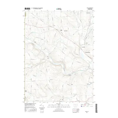
2016 Map of Utica
USGS Topo · Published 2016About this map
French Creek carves a central path through this Venango County landscape, anchoring a network of small settlements and rural homesteads. The borough of Utica sits along the creek’s bend, while the village of Polk occupies the southern reaches near Little Sandy Creek. The area’s geography is defined by a series of significant runs and creeks, including Sugar Creek, Warden Run, and Foster Run, which drain the surrounding highlands into the larger waterways.
Find a feature on this map
106 named features on this map. Tap any name to fly to it.
Don’t see what you’re looking for? This feature index may not catch every label — zoom into the map to look around manually.
Map Details
Editions of this 2016 Utica Map
This is the sole edition of this map. No revisions or reprints were ever made.
Other maps of this area

1909 · Franklin
USGS Topo · 1:62,500

1911 · Franklin
USGS Topo · 1:62,500

1911 · Stoneboro
USGS Topo · 1:62,500

1913 · Stoneboro
USGS Topo · 1:62,500

1923 · Meadville
USGS Topo · 1:62,500

1925 · Meadville
USGS Topo · 1:62,500

1927 · Townville
USGS Topo · 1:48,000

1932 · Townville
USGS Topo · 1:62,500

1943 · Meadville
USGS Topo · 1:62,500

1943 · Stoneboro
USGS Topo · 1:62,500