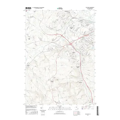
2016 Map of Utica West
USGS Topo · Published 2016About this map
Sauquoit Creek carves a path through the heart of the central Oneida County landscape, anchoring a string of mill towns and residential developments including New York Mills, Yorkville, and Whitesboro. The industrial and social geography of the region is well-represented, with significant institutional footprints such as Utica Coll and the Saint Elizabeth Coll of Nursing. To the south, the terrain rises toward Crow Hill and Grange Hill, where the suburban density of New Hartford gives way to the smaller settlements of Chuckery Corners and Paris.
Find a feature on this map
228 named features on this map. Tap any name to fly to it.
Don’t see what you’re looking for? This feature index may not catch every label — zoom into the map to look around manually.
Map Details
Editions of this 2016 Utica West Map
This is the sole edition of this map. No revisions or reprints were ever made.
Other maps of this area

1895 · Oriskany
USGS Topo · 1:62,500

1898 · Utica
USGS Topo · 1:62,500

1898 · Oriskany
USGS Topo · 1:62,500

1900 · Utica
USGS Topo · 1:62,500

1907 · Winfield
USGS Topo · 1:62,500

1907 · Sangerfield
USGS Topo · 1:62,500

1943 · Utica East
USGS Topo · 1:24,000

1943 · Cassville
USGS Topo · 1:24,000

1943 · Sangerfield
USGS Topo · 1:62,500
1943 · West Winfield
USGS Topo · 1:24,000