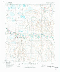
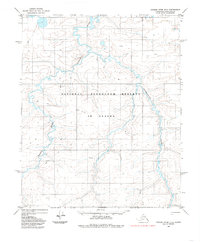
1955 Map of Utukok River C-3
USGS Topo · Published 1975About this map
The Utukok River meanders across this northern landscape, which was mapped by the Army Map Service during the mid-1950s. The entire region shown lies within the Naval Petroleum Reserve No. 4, a designation reflecting the strategic resource interests of the era. A prominent Winter Trail cuts across the northern terrain, providing a vital seasonal transportation route before more permanent infrastructure existed in this part of the North Slope. The presence of the tributary Kaotuk and a solitary marked Site suggests the transient nature of habitation and travel in this remote arctic environment. Aerial photography taken in 1955 captured the complex network of lakes and drainage patterns that defined the area prior to later petroleum exploration developments.
Find a feature on this map
7 named features on this map. Tap any name to fly to it.
Don’t see what you’re looking for? This feature index may not catch every label — zoom into the map to look around manually.
Map Details
Editions of this 1955 Utukok River C-3 Map
3 editions found
Other maps of this area

1951 · Utukok River
USGS Topo · 1:250,000
1955 · Utukok River C-3
USGS Topo · 1:63,360
1955 · Utukok River D-4
USGS Topo · 1:63,360
1955 · Utukok River D-3
USGS Topo · 1:63,360
1955 · Utukok River B-3
USGS Topo · 1:63,360
1955 · Utukok River B-4
USGS Topo · 1:63,360
1955 · Utukok River C-4
USGS Topo · 1:63,360

1956 · Utukok River
USGS Topo · 1:250,000

1965 · Utukok River
USGS Topo · 1:250,000
1984 · Utukok River D-2
USGS Topo · 1:63,360