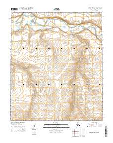
2014 Map of Utukok River C-3 SE
USGS Topo · Published 2014About this map
Utukok River dominates the northern reaches of this Arctic landscape, winding through a complex system of braided channels and seasonal sandbars. The terrain transitions from the low-lying fluvial deposits of the river valley into a series of rising uplands, defined by precise elevation data from the National Elevation Dataset. This map details the Public Land Survey System divisions for portions of t3n r35w, t3n r34w, t2n r35w, and t2n r34w, providing a structural look at the township and range grid in the remote North Slope. Because there are no permanent settlements or roads shown, the map serves as a primary record of the natural drainage patterns and topographical relief as they existed in the early twenty-first century.
Find a feature on this map
5 named features on this map. Tap any name to fly to it.
Don’t see what you’re looking for? This feature index may not catch every label — zoom into the map to look around manually.
Map Details
Editions of this 2014 Utukok River C-3 SE Map
This is the sole edition of this map. No revisions or reprints were ever made.
Other maps of this area

1951 · Utukok River
USGS Topo · 1:250,000
1955 · Utukok River C-3
USGS Topo · 1:63,360
1955 · Utukok River B-3
USGS Topo · 1:63,360

1956 · Utukok River
USGS Topo · 1:250,000

1965 · Utukok River
USGS Topo · 1:250,000
1984 · Utukok River C-2
USGS Topo · 1:63,360
1985 · Utukok River B-2
USGS Topo · 1:63,360
2014 · Utukok River C-2 NW
USGS Topo · 1:25,000
2014 · Utukok River B-2 NW
USGS Topo · 1:25,000
2014 · Utukok River C-3 SW
USGS Topo · 1:25,000