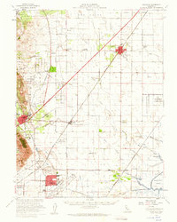
1953 Map of Vacaville
USGS Topo · Published 1959About this map
Travis Air Force Base and the emerging footprint of Vacaville anchor this mid-century portrait of Solano County's interior. The landscape is defined by its deep agricultural and transportation roots, where the Southern Pacific and Sacramento Northern railroads intersect at points like Vacaville Junction and Cordero Junction. Numerous small community centers and rural schoolhouses, including Olive School and Tremont School, dot the landscape between the larger hubs of Dixon and Vacaville. Along the eastern edge, the topography transitions into the complex waterways of the Sacramento Delta, featuring the Hastings Tract and a network of sloughs such as Barker Slough and Lindsey Slough. This survey captures the region as military infrastructure and institutional footprints, like the California Medical Facility, began to expand alongside established ranching boundaries such as Rio De Los Putos.
Find a feature on this map
68 named features on this map. Tap any name to fly to it.
Don’t see what you’re looking for? This feature index may not catch every label — zoom into the map to look around manually.
Map Details
Editions of this 1953 Vacaville Map
This is the sole edition of this map. No revisions or reprints were ever made.
Other maps of this area

1896 · Carquinez Strait
USGS Topo · 1:62,500

1898 · Karquines
USGS Topo · 1:62,500

1901 · Karquines
USGS Topo · 1:62,500

1902 · Napa
USGS Topo · 1:125,000

1907 · Woodland
USGS Topo · 1:62,500

1907 · Davisville
USGS Topo · 1:62,500

1907 · Antioch
USGS Topo · 1:62,500

1908 · Vacaville
USGS Topo · 1:62,500

1908 · Courtland
USGS Topo · 1:62,500

1908 · Antioch
USGS Topo · 1:62,500