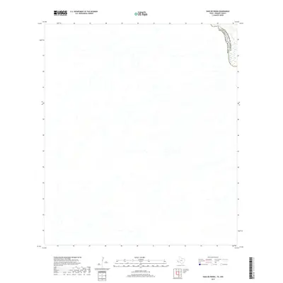
2019 Map of Vado De Piedra
USGS Topo · Published 2019About this map
Rio Grande waters define the northernmost edge of this desert landscape, where the international boundary of the United States of America Estados Unidos Mexicanos cuts through the high desert of Presidio County. This terrain is characterized by a dense network of dry washes and arroyos that drain toward the river corridor from the surrounding uplands. Mapping by the U.S. Geological Survey reveals a sparsely developed region where the physical geography dominates over human settlement. The intricate drainage patterns shown here provide a clear look at the hydrological character of the Trans-Pecos region, highlighting how the desert floor is sculpted by seasonal runoff long before it reaches the main channel of the river.
Find a feature on this map
2 named features on this map. Tap any name to fly to it.
Don’t see what you’re looking for? This feature index may not catch every label — zoom into the map to look around manually.
Map Details
Editions of this 2019 Vado De Piedra Map
This is the sole edition of this map. No revisions or reprints were ever made.
Other maps of this area

1896 · Ruidosa
USGS Topo · 1:125,000

1959 · Presidio
USGS Topo · 1:250,000

1965 · Presidio
USGS Topo · 1:250,000

1966 · Adobes
USGS Topo · 1:24,000

1978 · Sierra Parda
USGS Topo · 1:24,000
1979 · Indio
USGS Topo · 1:24,000
1980 · Las Conchas
USGS Topo · 1:24,000
1985 · Presidio
USGS Topo · 1:100,000
1993 · Presidio
USGS Topo · 1:100,000
2010 · Sierra Parda
USGS Topo · 1:24,000