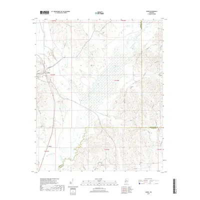
2018 Map of Vaiden
USGS Topo · Published 2018About this map
The town of Vaiden serves as a central hub where Hays Creek and Hurricane Cr converge, situated within a landscape defined by the winding course of the Big Black River. This 2018 survey reveals a high density of rural burial sites, highlighting the deep genealogical roots of the area through markers like the Shongola Cems, Everett Cem, and Shiloh Cem. The settlement pattern follows the local topography, with smaller locales such as Beatty and Providence connected by a network of county roads including Co RD 14 and Co RD 3122.
Find a feature on this map
69 named features on this map. Tap any name to fly to it.
Don’t see what you’re looking for? This feature index may not catch every label — zoom into the map to look around manually.
Map Details
Editions of this 2018 Vaiden Map
This is the sole edition of this map. No revisions or reprints were ever made.
Other maps of this area

1953 · West Point
USGS Topo · 1:250,000

1958 · West Point
USGS Topo · 1:250,000

1963 · West Point
USGS Topo · 1:250,000

1964 · West
USGS Topo · 1:24,000

1964 · Kosciusko NE
USGS Topo · 1:24,000

1964 · Hesterville
USGS Topo · 1:24,000

1966 · Kilmichael
USGS Topo · 1:24,000

1966 · Poplar Creek
USGS Topo · 1:24,000

1966 · Winona
USGS Topo · 1:24,000

1966 · Kosciusko
USGS Topo · 1:62,500