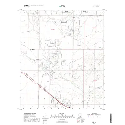
2018 Map of Vail
USGS Topo · Published 2018About this map
Vail and the surrounding high-desert landscape southeast of Tucson are documented in this 2018 survey, which shows a mix of rural ranch lands and modern suburban expansion. The northern edge of the map is defined by the boundary of Saguaro National Park, where the terrain transitions into the foothills of the Rincon Mountains. Key local landmarks include the Rincon Memorial Cem in the north and the Vail Childrens Cem further south near the burgeoning town center.
Find a feature on this map
132 named features on this map. Tap any name to fly to it.
Don’t see what you’re looking for? This feature index may not catch every label — zoom into the map to look around manually.
Map Details
Editions of this 2018 Vail Map
This is the sole edition of this map. No revisions or reprints were ever made.
Other maps of this area

1904 · Patagonia
USGS Topo · 1:125,000

1904 · Tucson
USGS Topo · 1:125,000

1905 · Patagonia
USGS Topo · 1:125,000

1905 · Tucson
USGS Topo · 1:125,000

1926 · Helvetia
USGS Topo · 1:62,500

1948 · Tucson
USGS Topo · 1:62,500

1956 · Nogales
USGS Topo · 1:250,000

1956 · Tucson
USGS Topo · 1:250,000

1957 · Tucson East
USGS Topo · 1:24,000

1957 · Tucson
USGS Topo · 1:62,500