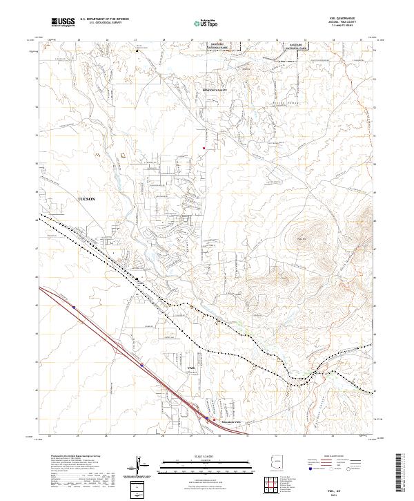
2021 Map of Vail
USGS Topo · Published 2021About this map
The Rincon Valley serves as a transition between the desert floor and the rising uplands of Saguaro National Park. This 2021 survey shows a landscape of modern residential expansion interwoven with deep-cut desert drainages like Pantano Wash and Cienega Cr. Near the settlement of Vail, the map documents local sites of genealogical interest, including the Vail Childrens Cem and the Rincon Memorial Cem further north.
Find a feature on this map
135 named features on this map. Tap any name to fly to it.
Don’t see what you’re looking for? This feature index may not catch every label — zoom into the map to look around manually.
Map Details
Editions of this 2021 Vail Map
This is the sole edition of this map. No revisions or reprints were ever made.
Other maps of this area

1904 · Patagonia
USGS Topo · 1:125,000

1904 · Tucson
USGS Topo · 1:125,000

1905 · Patagonia
USGS Topo · 1:125,000

1905 · Tucson
USGS Topo · 1:125,000

1926 · Helvetia
USGS Topo · 1:62,500

1948 · Tucson
USGS Topo · 1:62,500

1956 · Nogales
USGS Topo · 1:250,000

1956 · Tucson
USGS Topo · 1:250,000

1957 · Tucson East
USGS Topo · 1:24,000

1957 · Tucson
USGS Topo · 1:62,500