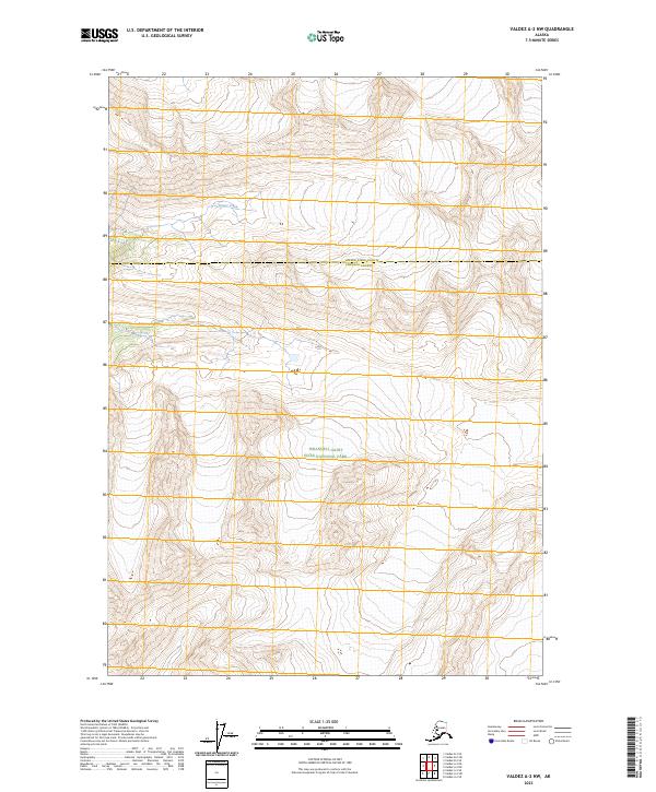
2023 Map of Valdez A-2 NW
USGS Topo · Published 2023About this map
Wrangell-Saint Elias National Park encompasses the majority of this Alaskan wilderness landscape, where the high mountain terrain is defined by steep contours and glacial drainages. The northern portion of the sheet transitions into the Wrangell-St. Elias Wilderness, a designation reflecting the preserved state of this interior region. The most prominent water feature is Dewey Creek, which flows through the northwestern quadrant of the quadrangle. A significant administrative boundary also crosses the center of the map, marking the divide between Copper River County and Chugach County. This 2023 survey provides a clear look at the undeveloped character of the Copper River region, emphasizing the scale of protected federal lands and the natural drainage patterns that have shaped the area's geological history.
Find a feature on this map
8 named features on this map. Tap any name to fly to it.
Don’t see what you’re looking for? This feature index may not catch every label — zoom into the map to look around manually.
Map Details
Editions of this 2023 Valdez A-2 NW Map
This is the sole edition of this map. No revisions or reprints were ever made.
Other maps of this area

1950 · Valdez A-3
USGS Topo · 1:63,360

1951 · Valdez B-2
USGS Topo · 1:63,360

1951 · Valdez B-3
USGS Topo · 1:63,360

1951 · Valdez A-2
USGS Topo · 1:63,360

1952 · Valdez
USGS Topo · 1:250,000

1953 · Valdez A-3
USGS Topo · 1:63,360
1957 · Valdez A-2
USGS Topo · 1:63,360

1960 · Valdez
USGS Topo · 1:250,000
1994 · Valdez A-3
USGS Topo · 1:63,360
1995 · Valdez B-3
USGS Topo · 1:63,360