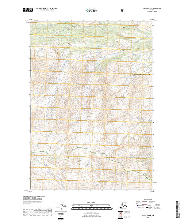
2023 Map of Valdez A-3 NW
USGS Topo · Published 2023About this map
The Chugach National Forest encompasses the southern reaches of this landscape, where steep high-altitude terrain meets the drainage basins of the interior. The topographic detail follows a network of alpine water systems, most notably the Tiekel River which flows across the northern edge of the sheet. Further south, the remote paths of Thunder Creek and Cleave Creek cut through deep relief, illustrating the natural drainage patterns of this unpopulated wilderness area. This 2023 survey clarifies the administrative boundary between Copper River County and Chugach County, a line that traverses the center of the quadrangle. The lack of roads or human-built structures emphasizes a landscape defined entirely by its hydrology and elevation, serving as a primary record of the glacial and riverine morphology that shapes this portion of Alaska.
Find a feature on this map
9 named features on this map. Tap any name to fly to it.
Don’t see what you’re looking for? This feature index may not catch every label — zoom into the map to look around manually.
Map Details
Editions of this 2023 Valdez A-3 NW Map
This is the sole edition of this map. No revisions or reprints were ever made.
Other maps of this area

1950 · Valdez A-3
USGS Topo · 1:63,360

1951 · Valdez B-3
USGS Topo · 1:63,360

1951 · Valdez B-4
USGS Topo · 1:63,360

1952 · Valdez
USGS Topo · 1:250,000

1953 · Valdez B-4
USGS Topo · 1:63,360

1953 · Valdez A-4
USGS Topo · 1:63,360

1953 · Valdez A-3
USGS Topo · 1:63,360

1960 · Valdez
USGS Topo · 1:250,000
1994 · Valdez A-3
USGS Topo · 1:63,360
1994 · Valdez A-4
USGS Topo · 1:63,360