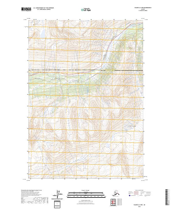
2023 Map of Valdez A-4 NW
USGS Topo · Published 2023About this map
The Tsina River flows through this rugged corridor of the Chugach Mountains, providing a natural pathway for critical infrastructure. Modern engineering is heavily represented here, as the Alaska Pipeline and the Richardson Highway parallel the river's course through the mountain passes. The map highlights the sharp relief between the river valleys and high peaks such as Mt Dimond in the northwest corner. This area serves as a primary transit link between the interior and the coast, crossing the boundary between the Copper River Census Area and Chugach Census Area. Further south, the terrain transitions toward the headwaters of the Lowe River, illustrating the complex drainage patterns of the Alaskan wilderness.
Find a feature on this map
11 named features on this map. Tap any name to fly to it.
Don’t see what you’re looking for? This feature index may not catch every label — zoom into the map to look around manually.
Map Details
Editions of this 2023 Valdez A-4 NW Map
This is the sole edition of this map. No revisions or reprints were ever made.
Other maps of this area

1951 · Valdez B-5
USGS Topo · 1:63,360

1951 · Valdez B-4
USGS Topo · 1:63,360

1952 · Valdez
USGS Topo · 1:250,000

1953 · Valdez B-4
USGS Topo · 1:63,360

1953 · Valdez A-4
USGS Topo · 1:63,360

1953 · Valdez A-5
USGS Topo · 1:63,360

1960 · Valdez
USGS Topo · 1:250,000
1994 · Valdez A-4
USGS Topo · 1:63,360

1994 · Valdez B-4
USGS Topo · 1:63,360
1995 · Valdez B-5
USGS Topo · 1:63,360