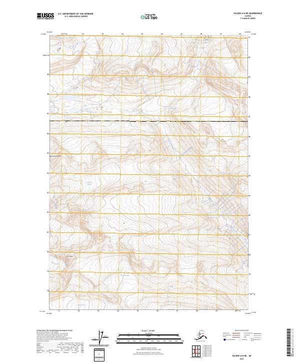
2023 Map of Valdez A-6 NE
USGS Topo · Published 2023About this map
Prospectors Peak and East Peak dominate this high-altitude Alaskan landscape, where glacial movement continues to define the geography. The sheet detail covers several significant ice bodies, including the central mass of Comicia Glacier and the southern reach of Keystone Glacier, which feeds into the surrounding drainages. Below the ice line, narrow watercourses like Sheep Creek and Slater Creek carve through the steep terrain within the boundaries of t8s r4w and t7s r5w. This modern survey illustrates a wilderness defined by persistent ice and high summits, where the land is largely shaped by natural forces rather than human development. The northern edge of the Rubin Glacier is also visible, marking the transition into the neighboring glacial systems of the Valdez region.
Find a feature on this map
11 named features on this map. Tap any name to fly to it.
Don’t see what you’re looking for? This feature index may not catch every label — zoom into the map to look around manually.
Map Details
Editions of this 2023 Valdez A-6 NE Map
This is the sole edition of this map. No revisions or reprints were ever made.
Other maps of this area

1951 · Valdez B-5
USGS Topo · 1:63,360

1951 · Valdez B-6
USGS Topo · 1:63,360

1951 · Valdez A-6
USGS Topo · 1:63,360

1952 · Valdez
USGS Topo · 1:250,000

1952 · Valdez A-6
USGS Topo · 1:63,360

1953 · Valdez B-6
USGS Topo · 1:63,360

1953 · Valdez A-5
USGS Topo · 1:63,360

1960 · Valdez
USGS Topo · 1:250,000
1983 · Valdez A-6 SW
USGS Topo · 1:25,000
1983 · Valdez A-6 NW
USGS Topo · 1:25,000