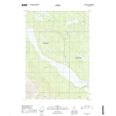
2019 Map of Valdez B-1 NE
USGS Topo · Published 2019About this map
Wrangell-St. Elias National Park and the adjacent Wrangell-St. Elias National Preserve dominate this portion of the Copper River basin. The landscape is defined by the broad, braided course of the Chitina River, which flows westward through the center of the sheet, joined by the Kuskulana River and the Tebay River. In the northern highlands, Strelna Lake and Van Lake sit near the historic corridor of the Edgerton Hwy / McCarthy Rd. This road, a vital artery for the region, follows the general path of the old Copper River and Northwestern Railway, providing access to this remote wilderness. The map captures the complex drainage patterns and glacial outwash plains that characterize this protected Alaskan interior.
Find a feature on this map
15 named features on this map. Tap any name to fly to it.
Don’t see what you’re looking for? This feature index may not catch every label — zoom into the map to look around manually.
Map Details
Editions of this 2019 Valdez B-1 NE Map
This is the sole edition of this map. No revisions or reprints were ever made.
Other maps of this area

1951 · McCarthy
USGS Topo · 1:250,000

1951 · Valdez B-1
USGS Topo · 1:63,360

1951 · McCarthy C-8
USGS Topo · 1:63,360

1951 · McCarthy B-8
USGS Topo · 1:63,360

1951 · Valdez C-1
USGS Topo · 1:63,360

1952 · Valdez
USGS Topo · 1:250,000

1953 · Valdez C-1
USGS Topo · 1:63,360

1960 · McCarthy
USGS Topo · 1:250,000

1960 · Valdez
USGS Topo · 1:250,000

1995 · McCarthy B-8
USGS Topo · 1:63,360