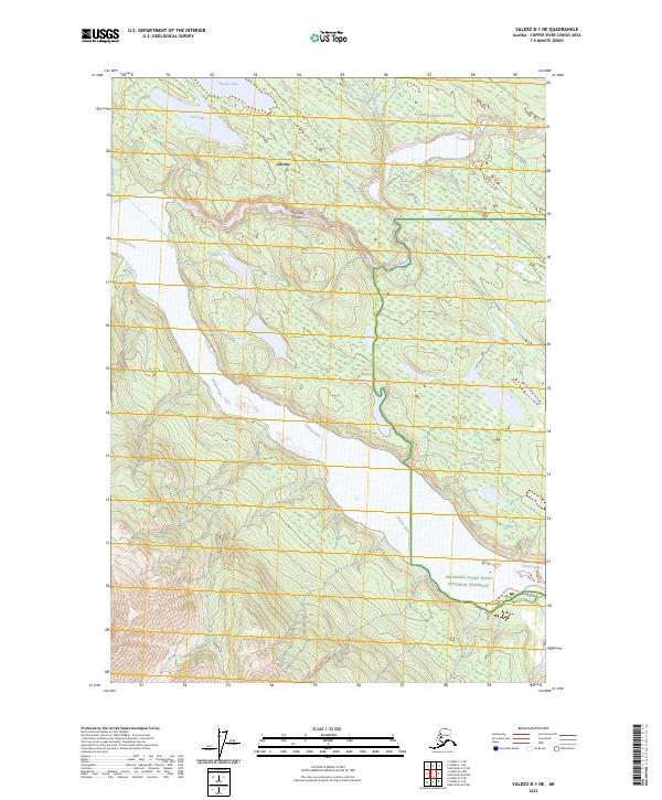
2023 Map of Valdez B-1 NE
USGS Topo · Published 2023About this map
Chitina and the northern banks of the braided Chitina River define the northern corridor of this Copper River region. The landscape is dominated by the transitions between the Wrangell-Saint Elias National Park, the Wrangell-Saint Elias National Preserve, and the protected Wrangell-St. Elias Wilderness. The historic McCarthy Road provides the primary overland route across the northern portion of the sheet, crossing the Kuskulana River and Strelna Creek. This survey captures the hydrologic network of the high country, including Strelna Lake and Van Lake, while tracking the Tebay River as it joins the larger glacial drainage systems. The presence of Islas San Antonio within the riverbed illustrates the shifting, multi-channel nature of the river plains in this part of Alaska.
Find a feature on this map
18 named features on this map. Tap any name to fly to it.
Don’t see what you’re looking for? This feature index may not catch every label — zoom into the map to look around manually.
Map Details
Editions of this 2023 Valdez B-1 NE Map
This is the sole edition of this map. No revisions or reprints were ever made.
Other maps of this area

1951 · McCarthy
USGS Topo · 1:250,000

1951 · Valdez B-1
USGS Topo · 1:63,360

1951 · McCarthy C-8
USGS Topo · 1:63,360

1951 · McCarthy B-8
USGS Topo · 1:63,360

1951 · Valdez C-1
USGS Topo · 1:63,360

1952 · Valdez
USGS Topo · 1:250,000

1953 · Valdez C-1
USGS Topo · 1:63,360

1960 · McCarthy
USGS Topo · 1:250,000

1960 · Valdez
USGS Topo · 1:250,000

1995 · McCarthy B-8
USGS Topo · 1:63,360