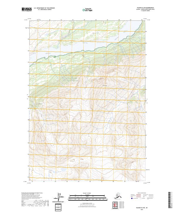
2023 Map of Valdez B-2 SW
USGS Topo · Published 2023About this map
The Copper River dominates the northern landscape of this region, carved into the dramatic topography of the Chugach and Wrangell ranges. Flowing westward across the upper section of the map, it is joined by the Uranatina River as it traverses some of the most preserved wilderness in Alaska. This 2023 survey emphasizes the conservation status of the area, which is entirely contained within the Wrangell-Saint Elias National Park and the contiguous Wrangell-St. Elias Wilderness. Rising sharply from the river valley, Spirit Mtn serves as a prominent landmark in the center of the sheet, illustrating the extreme elevation changes characteristic of this corridor. The map provides a current-day look at the hydrologic and topographic patterns that have long dictated movement and settlement along the river basin.
Find a feature on this map
9 named features on this map. Tap any name to fly to it.
Don’t see what you’re looking for? This feature index may not catch every label — zoom into the map to look around manually.
Map Details
Editions of this 2023 Valdez B-2 SW Map
This is the sole edition of this map. No revisions or reprints were ever made.
Other maps of this area

1950 · Valdez A-3
USGS Topo · 1:63,360

1951 · Valdez B-2
USGS Topo · 1:63,360

1951 · Valdez B-3
USGS Topo · 1:63,360

1951 · Valdez A-2
USGS Topo · 1:63,360

1952 · Valdez
USGS Topo · 1:250,000

1953 · Valdez A-3
USGS Topo · 1:63,360
1957 · Valdez A-2
USGS Topo · 1:63,360

1960 · Valdez
USGS Topo · 1:250,000
1994 · Valdez A-3
USGS Topo · 1:63,360
1995 · Valdez B-3
USGS Topo · 1:63,360