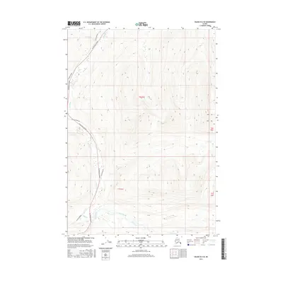
2016 Map of Valdez B-4 SE
USGS Topo · Published 2016About this map
The Tiekel River valley serves as a primary corridor for modern Alaskan infrastructure, carving through the high elevations of the Unorganized Borough. Parallel ribbons of transportation and energy dominate the western edge of this survey, where the Richardson Highway and the Alaska Pipeline follow the natural contours of the river's path. These critical lifelines facilitate movement between the interior and the coast, crossing numerous tributaries such as Squaw Cr and Stuart Cr. To the east, the landscape transitions into a network of steep drainage basins and alpine peaks, defined by Fall Cr and the Tsina River. The mapping of these townships highlights the relationship between the state's challenging geography and the essential engineering projects that traverse it.
Find a feature on this map
11 named features on this map. Tap any name to fly to it.
Don’t see what you’re looking for? This feature index may not catch every label — zoom into the map to look around manually.
Map Details
Editions of this 2016 Valdez B-4 SE Map
This is the sole edition of this map. No revisions or reprints were ever made.
Other maps of this area

1950 · Valdez A-3
USGS Topo · 1:63,360

1951 · Valdez B-3
USGS Topo · 1:63,360

1951 · Valdez B-4
USGS Topo · 1:63,360

1952 · Valdez
USGS Topo · 1:250,000

1953 · Valdez B-4
USGS Topo · 1:63,360

1953 · Valdez A-4
USGS Topo · 1:63,360

1953 · Valdez A-3
USGS Topo · 1:63,360

1960 · Valdez
USGS Topo · 1:250,000
1994 · Valdez A-3
USGS Topo · 1:63,360
1994 · Valdez A-4
USGS Topo · 1:63,360