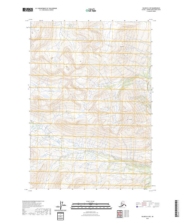
2023 Map of Valdez B-4 SW
USGS Topo · Published 2023About this map
The Alaska Pipeline cuts a distinct path through this mountain landscape, tracing a narrow corridor across the northeast and southeast sectors of the quadrangle. This industrial infrastructure contrasts sharply with the massive natural elevations of Mt Tiekel and Rice Mtn, which dominate the central and northern terrain. Drainage patterns for the area are defined by several watercourses including Boulder Creek, Glacier Creek, and Stuart Creek, which carve through the high-altitude topography. The map illustrates a specialized landscape where modern energy infrastructure is integrated into a largely uninhabited and high-relief environment, showing how human engineering navigates the extreme verticality of the Copper River region.
Find a feature on this map
12 named features on this map. Tap any name to fly to it.
Don’t see what you’re looking for? This feature index may not catch every label — zoom into the map to look around manually.
Map Details
Editions of this 2023 Valdez B-4 SW Map
This is the sole edition of this map. No revisions or reprints were ever made.
Other maps of this area

1951 · Valdez B-5
USGS Topo · 1:63,360

1951 · Valdez B-4
USGS Topo · 1:63,360

1952 · Valdez
USGS Topo · 1:250,000

1953 · Valdez B-4
USGS Topo · 1:63,360

1953 · Valdez A-4
USGS Topo · 1:63,360

1953 · Valdez A-5
USGS Topo · 1:63,360

1960 · Valdez
USGS Topo · 1:250,000
1994 · Valdez A-4
USGS Topo · 1:63,360

1994 · Valdez B-4
USGS Topo · 1:63,360
1995 · Valdez B-5
USGS Topo · 1:63,360