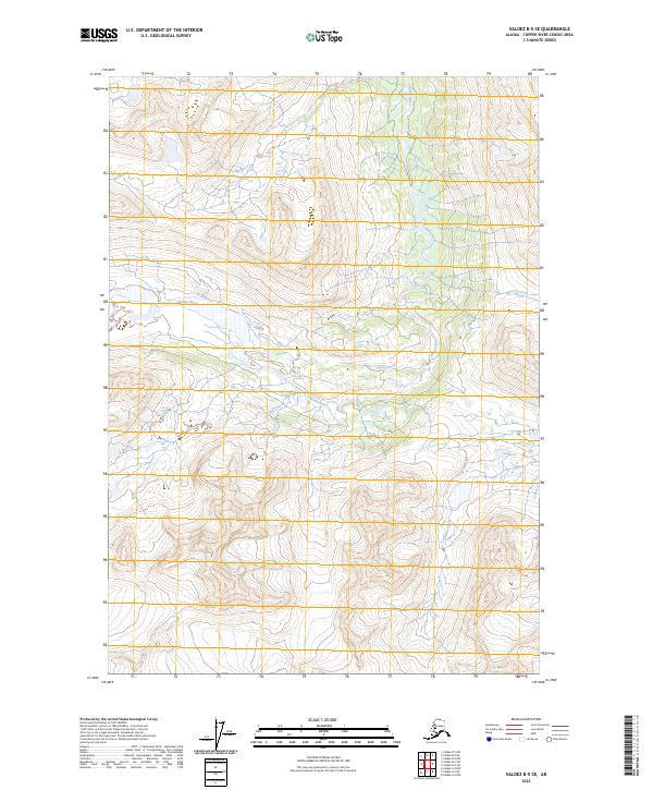
2023 Map of Valdez B-5 SE
USGS Topo · Published 2023About this map
Tonsina River defines the central corridor of this interior Alaskan landscape, winding through a complex system of glacial valleys and mountain slopes. The hydrology of the Copper River Census Area is highly active here, with numerous unnamed tributaries feeding into larger arteries like Glacier Creek and Stuart Creek. This 2023 survey illustrates the remote character of the region, where the terrain is dominated by the natural drainage patterns of the high country rather than human infrastructure or settlement. The map serves as a contemporary record of the shifting watercourses and elevation gradients in the Copper River basin, offering a clear view of the natural topography in the areas designated by township boundaries t6s r2w and t7s r2w.
Find a feature on this map
7 named features on this map. Tap any name to fly to it.
Don’t see what you’re looking for? This feature index may not catch every label — zoom into the map to look around manually.
Map Details
Editions of this 2023 Valdez B-5 SE Map
This is the sole edition of this map. No revisions or reprints were ever made.
Other maps of this area

1951 · Valdez B-5
USGS Topo · 1:63,360

1951 · Valdez B-4
USGS Topo · 1:63,360

1952 · Valdez
USGS Topo · 1:250,000

1953 · Valdez B-4
USGS Topo · 1:63,360

1953 · Valdez A-4
USGS Topo · 1:63,360

1953 · Valdez A-5
USGS Topo · 1:63,360

1960 · Valdez
USGS Topo · 1:250,000
1994 · Valdez A-4
USGS Topo · 1:63,360

1994 · Valdez B-4
USGS Topo · 1:63,360
1995 · Valdez B-5
USGS Topo · 1:63,360