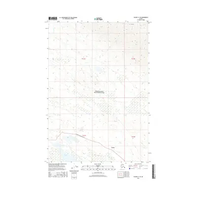
2016 Map of Valdez C-1 SE
USGS Topo · Published 2016About this map
The small settlement of Strelna serves as the primary focal point of this 2016 survey, situated along the historic corridor of the Edgerton Hwy/mccarthy Rd. This route represents a vital artery for the region, providing access through the southern reaches of Wrangell-Saint Elias National Park. The landscape is defined by the drainage basins of several waterways, including Strelna Cr and the waters of Strelna Lake, which sit at the base of significant elevation shifts. To the north, the terrain rises sharply toward Iron Mtn, where the headwaters of Iron Cr, Cou Cr, and Benito Cr carve through the high country. The map illustrates the sparsely populated nature of this Alaskan interior, where infrastructure is limited to the single highway corridor amidst a vast network of glacial streams and mountain peaks.
Find a feature on this map
14 named features on this map. Tap any name to fly to it.
Don’t see what you’re looking for? This feature index may not catch every label — zoom into the map to look around manually.
Map Details
Editions of this 2016 Valdez C-1 SE Map
This is the sole edition of this map. No revisions or reprints were ever made.
Other maps of this area

1951 · McCarthy
USGS Topo · 1:250,000

1951 · Valdez B-1
USGS Topo · 1:63,360

1951 · McCarthy C-8
USGS Topo · 1:63,360

1951 · McCarthy B-8
USGS Topo · 1:63,360

1951 · Valdez C-1
USGS Topo · 1:63,360

1952 · Valdez
USGS Topo · 1:250,000

1953 · Valdez C-1
USGS Topo · 1:63,360

1960 · McCarthy
USGS Topo · 1:250,000

1960 · Valdez
USGS Topo · 1:250,000

1995 · McCarthy B-8
USGS Topo · 1:63,360