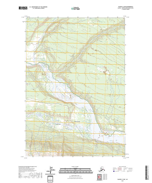
2023 Map of Valdez C-2 NW
USGS Topo · Published 2023About this map
The confluence of major glacial waterways defines this Alaskan landscape, where the wide, braided channel of the Copper River meets the Tonsina River. In the southern portion of the sheet, the settlements of Kenny Lake and Lower Tonsina represent the primary residential footprint within this riverine corridor. The terrain is characterized by the complex drainage patterns of Hundell Creek and the Cheshnina River, which cut through the northern reaches of the quadrangle. A significant portion of the western territory is designated as the Wrangell-Saint Elias National Preserve, a massive protected area that underscores the wilderness character of the Copper River Census Area. The map illustrates the 21st-century road network connecting these remote communities, providing a clear view of how human habitation follows the natural contours and river valleys of the interior.
Find a feature on this map
13 named features on this map. Tap any name to fly to it.
Don’t see what you’re looking for? This feature index may not catch every label — zoom into the map to look around manually.
Map Details
Editions of this 2023 Valdez C-2 NW Map
This is the sole edition of this map. No revisions or reprints were ever made.
Other maps of this area

1951 · Valdez C-2
USGS Topo · 1:63,360

1951 · Valdez C-3
USGS Topo · 1:63,360

1952 · Valdez
USGS Topo · 1:250,000

1953 · Valdez C-2
USGS Topo · 1:63,360

1953 · Valdez C-3
USGS Topo · 1:63,360

1958 · Valdez D-3
USGS Topo · 1:63,360

1959 · Valdez D-2
USGS Topo · 1:63,360

1960 · Valdez
USGS Topo · 1:250,000
1996 · Valdez D-3
USGS Topo · 1:63,360

1996 · Valdez C-2
USGS Topo · 1:63,360