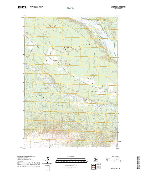
2023 Map of Valdez C-3 NE
USGS Topo · Published 2023About this map
Wrangell-Saint Elias National Preserve dominates the northern landscape of this interior Alaska region, where the massive Copper River corridor meets the glacial runoff of the Tonsina River. This 2023 survey illustrates the rugged hydrology of the Copper River Basin, featuring Kenny Lake as a central water body in an area defined by extensive wetlands and complex drainage patterns. The map details the local transportation network through the Tonsina River Trl, which follows the river's path through the southern townships. The topography transitions from the alluvial flats of the river valleys to the rising elevations of the surrounding ranges, providing an essential record of the natural boundaries between T1S R3E and T3S R4E within the Copper River Census Area.
Find a feature on this map
11 named features on this map. Tap any name to fly to it.
Don’t see what you’re looking for? This feature index may not catch every label — zoom into the map to look around manually.
Map Details
Editions of this 2023 Valdez C-3 NE Map
This is the sole edition of this map. No revisions or reprints were ever made.
Other maps of this area

1951 · Valdez C-2
USGS Topo · 1:63,360

1951 · Valdez C-3
USGS Topo · 1:63,360

1952 · Valdez
USGS Topo · 1:250,000

1953 · Valdez C-2
USGS Topo · 1:63,360

1953 · Valdez C-3
USGS Topo · 1:63,360

1958 · Valdez D-3
USGS Topo · 1:63,360

1959 · Valdez D-2
USGS Topo · 1:63,360

1960 · Valdez
USGS Topo · 1:250,000
1996 · Valdez D-3
USGS Topo · 1:63,360

1996 · Valdez C-2
USGS Topo · 1:63,360