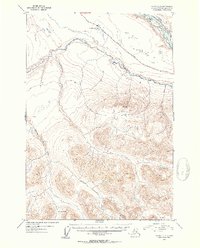
1953 Map of Valdez C-3
USGS Topo · Published 1954About this map
The Tonsina River carves through this Interior Alaska landscape, flowing toward its confluence with the Copper River in a region defined by high mountain passes and glacial drainage systems. Surveyed in the early 1950s, the map illustrates the early alignment of the Edgerton Cutoff, a vital overland link connecting the copper-rich interior to the coast. This corridor follows the natural contours of the valley, passing near the small water body at Kenney Lake. To the south, the topography rises sharply toward Kimball Pass, where high-altitude drainages like Dust Creek and Bernard Creek begin their descent. The transition from the broad river flats to the steep, unsurveyed alpine territory reflects the mid-century challenges of mapping the Alaskan frontier before comprehensive ground surveys reached every peak.
Find a feature on this map
7 named features on this map. Tap any name to fly to it.
Don’t see what you’re looking for? This feature index may not catch every label — zoom into the map to look around manually.
Map Details
Editions of this 1953 Valdez C-3 Map
2 editions found

Other maps of this area

1949 · Valdez D-4
USGS Topo · 1:63,360

1951 · Valdez B-2
USGS Topo · 1:63,360

1951 · Valdez B-3
USGS Topo · 1:63,360

1951 · Valdez C-2
USGS Topo · 1:63,360

1951 · Valdez C-3
USGS Topo · 1:63,360

1951 · Valdez C-4
USGS Topo · 1:63,360

1951 · Valdez B-4
USGS Topo · 1:63,360

1952 · Valdez
USGS Topo · 1:250,000

1952 · Valdez D-4
USGS Topo · 1:63,360

1953 · Valdez C-2
USGS Topo · 1:63,360