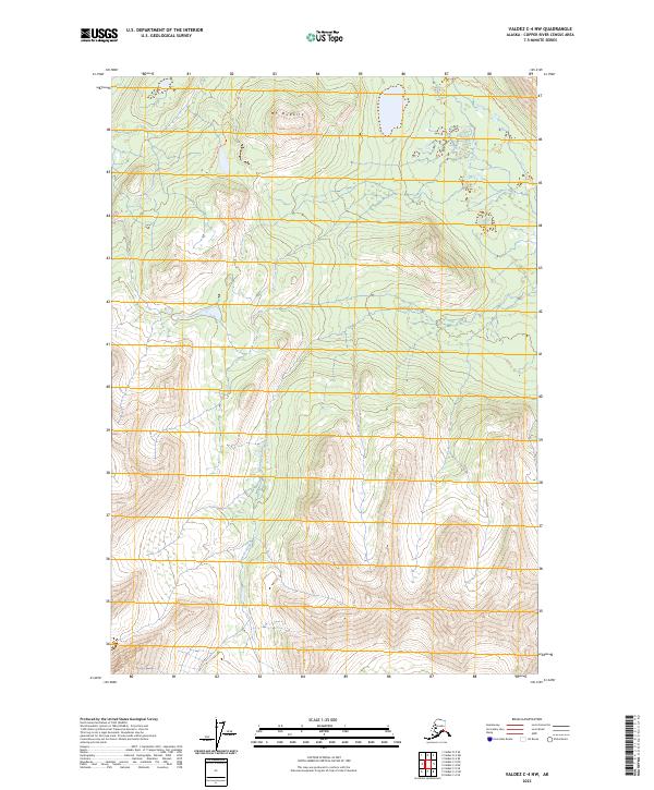
2023 Map of Valdez C-4 NW
USGS Topo · Published 2023About this map
Mt Durelle dominates the northern terrain of this high-elevation landscape in the Copper River Census Area. The map depicts a rugged interior dominated by steep contours and glacial drainages, where Squirrel Creek flows through the central valleys. Human presence is sparse, represented primarily by the Durelle Lake Trl which skirts the northern boundary, suggesting a region focused on wilderness navigation rather than permanent settlement. The survey provides a clear view of the complex hydrography and elevation changes within the Wrangell-St. Elias vicinity, focusing on the natural topography of the Valdez C-4 NW quadrangle.
Find a feature on this map
9 named features on this map. Tap any name to fly to it.
Don’t see what you’re looking for? This feature index may not catch every label — zoom into the map to look around manually.
Map Details
Editions of this 2023 Valdez C-4 NW Map
This is the sole edition of this map. No revisions or reprints were ever made.
Other maps of this area

1948 · Valdez D-5
USGS Topo · 1:63,360

1949 · Valdez D-4
USGS Topo · 1:63,360

1951 · Valdez D-5
USGS Topo · 1:63,360

1951 · Valdez C-4
USGS Topo · 1:63,360

1951 · Valdez C-5
USGS Topo · 1:63,360

1952 · Valdez
USGS Topo · 1:250,000

1952 · Valdez D-4
USGS Topo · 1:63,360

1953 · Valdez C-5
USGS Topo · 1:63,360

1953 · Valdez C-4
USGS Topo · 1:63,360

1960 · Valdez
USGS Topo · 1:250,000