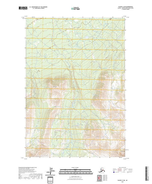
2023 Map of Valdez C-5 NE
USGS Topo · Published 2023About this map
Mt Simpson rises as a prominent landmark in this corner of the Copper River Census Area, overlooking a landscape defined by the drainage of Manker Creek. The stream system flows through a high-elevation valley, eventually feeding the broader river network that characterizes this part of the Alaskan interior. The Mahlo River also cuts through the terrain, illustrating the glacial and hydraulic forces that continue to shape the regional topography. This 2023 survey by the U.S. Geological Survey provides a clear view of the wilderness before significant modern infrastructure, focusing on the natural watercourses and peaks that have served as navigational waypoints for generations of travelers and explorers in the Valdez region.
Find a feature on this map
9 named features on this map. Tap any name to fly to it.
Don’t see what you’re looking for? This feature index may not catch every label — zoom into the map to look around manually.
Map Details
Editions of this 2023 Valdez C-5 NE Map
This is the sole edition of this map. No revisions or reprints were ever made.
Other maps of this area

1948 · Valdez D-5
USGS Topo · 1:63,360

1949 · Valdez D-4
USGS Topo · 1:63,360

1951 · Valdez D-5
USGS Topo · 1:63,360

1951 · Valdez C-4
USGS Topo · 1:63,360

1951 · Valdez C-5
USGS Topo · 1:63,360

1952 · Valdez
USGS Topo · 1:250,000

1952 · Valdez D-4
USGS Topo · 1:63,360

1953 · Valdez C-5
USGS Topo · 1:63,360

1953 · Valdez C-4
USGS Topo · 1:63,360

1960 · Valdez
USGS Topo · 1:250,000