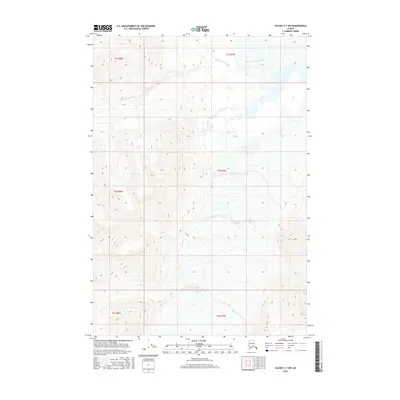
2016 Map of Valdez C-7 NW
USGS Topo · Published 2016About this map
Tazlina Glacier dominates the southern reaches of this landscape, its expansive white ice field flowing between steep topographic ridges in the Unorganized Borough. This 2016 survey shows the dramatic transition from high-elevation glacial ice to the valley floor, where glacial meltwater feeds the headwaters of Klanelneechena Creek. The map illustrates the complex drainage patterns common in this part of Alaska, with the smaller Klanelneechena Cr cutting through deep contour intervals as it descends from the northern slopes. The area is defined by its sheer lack of human infrastructure, focusing instead on the precise natural contours and glacial boundaries within the Public Land Survey System grids, including townships like t2s r7w.
Find a feature on this map
10 named features on this map. Tap any name to fly to it.
Don’t see what you’re looking for? This feature index may not catch every label — zoom into the map to look around manually.
Map Details
Editions of this 2016 Valdez C-7 NW Map
This is the sole edition of this map. No revisions or reprints were ever made.
Other maps of this area

1949 · Valdez D-8
USGS Topo · 1:63,360

1949 · Valdez D-7
USGS Topo · 1:63,360

1951 · Valdez D-7
USGS Topo · 1:63,360

1952 · Valdez D-8
USGS Topo · 1:63,360

1952 · Valdez
USGS Topo · 1:250,000

1960 · Valdez C-7
USGS Topo · 1:63,360

1960 · Valdez C-8
USGS Topo · 1:63,360

1960 · Valdez
USGS Topo · 1:250,000
1993 · Valdez D-7
USGS Topo · 1:63,360
1993 · Valdez D-8
USGS Topo · 1:63,360