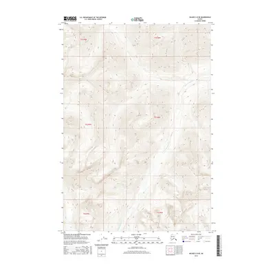
2016 Map of Valdez C-8 NE
USGS Topo · Published 2016About this map
Klanelneechena Cr carves a deep path through the high-elevation terrain of the Valdez C-8 NE quadrangle, serving as the primary drainage for this remote Alaskan landscape. The 2016 survey illustrates the intricate drainage patterns and steep relief characteristic of the region north of the Chugach Mountains, where the creek winds through sections of t1s r8w, t2s r8w, and t3s r9w. The map focuses on the raw topography and natural watercourses, providing a clear view of the land before any significant road or settlement infrastructure was established in this specific township and range block.
Find a feature on this map
7 named features on this map. Tap any name to fly to it.
Don’t see what you’re looking for? This feature index may not catch every label — zoom into the map to look around manually.
Map Details
Editions of this 2016 Valdez C-8 NE Map
This is the sole edition of this map. No revisions or reprints were ever made.
Other maps of this area

1949 · Valdez D-8
USGS Topo · 1:63,360

1949 · Valdez D-7
USGS Topo · 1:63,360

1951 · Valdez D-7
USGS Topo · 1:63,360

1952 · Valdez D-8
USGS Topo · 1:63,360

1952 · Valdez
USGS Topo · 1:250,000

1960 · Valdez C-7
USGS Topo · 1:63,360

1960 · Valdez C-8
USGS Topo · 1:63,360

1960 · Valdez
USGS Topo · 1:250,000
1993 · Valdez D-7
USGS Topo · 1:63,360
1993 · Valdez D-8
USGS Topo · 1:63,360