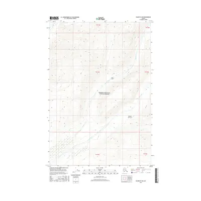
2016 Map of Valdez D-2 NE
USGS Topo · Published 2016About this map
Wrangell-Saint Elias National Preserve encompasses the heart of this landscape, where the high alpine peaks of the Wrangell Mountains dominate the horizon. This 2016 survey highlights a remote Alaskan wilderness defined by glacial drainages and sharp topographic relief. The Chichokna River and Chetaslina River cut through the terrain, fed by the runoff from higher elevations like Sheep Gulch. The map demonstrates the complex drainage patterns typical of this sub-arctic environment, showing how these waterways navigate the base of the mountains before converging. For researchers of Alaskan geography, the map provides a precise look at the township and range lines, such as t2n r5e, as they overlay this largely roadless preserve.
Find a feature on this map
11 named features on this map. Tap any name to fly to it.
Don’t see what you’re looking for? This feature index may not catch every label — zoom into the map to look around manually.
Map Details
Editions of this 2016 Valdez D-2 NE Map
This is the sole edition of this map. No revisions or reprints were ever made.
Other maps of this area

1951 · Gulkana
USGS Topo · 1:250,000

1952 · Valdez
USGS Topo · 1:250,000

1959 · Valdez D-2
USGS Topo · 1:63,360
1959 · Gulkana A-1
USGS Topo · 1:63,360
1959 · Gulkana A-2
USGS Topo · 1:63,360

1959 · Gulkana
USGS Topo · 1:250,000

1959 · Valdez D-1
USGS Topo · 1:63,360

1960 · Valdez
USGS Topo · 1:250,000

1965 · Gulkana
USGS Topo · 1:250,000
1996 · Valdez D-1
USGS Topo · 1:63,360