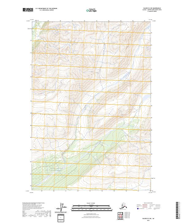
2023 Map of Valdez D-2 NE
USGS Topo · Published 2023About this map
The Wrangell Mountains dominate this high-altitude landscape, where the Chichokna River and Chetaslina River cut through the glacier-sculpted terrain. This interior Alaskan environment is defined by its transition from the Wrangell-Saint Elias National Preserve in the southwest to the strictly protected Wrangell-St. Elias Wilderness in the southeast. The topographic data reveals a complex drainage system, including the steep descent of Sheep Gulch as it feeds into the broader river basins. The lack of roads or established settlements on this map underscores the primitive nature of this protected mountain range, providing a clear record of modern wilderness boundaries and the natural watercourse patterns that define the region's geography.
Find a feature on this map
12 named features on this map. Tap any name to fly to it.
Don’t see what you’re looking for? This feature index may not catch every label — zoom into the map to look around manually.
Map Details
Editions of this 2023 Valdez D-2 NE Map
This is the sole edition of this map. No revisions or reprints were ever made.
Other maps of this area

1951 · Gulkana
USGS Topo · 1:250,000

1952 · Valdez
USGS Topo · 1:250,000

1959 · Valdez D-2
USGS Topo · 1:63,360
1959 · Gulkana A-1
USGS Topo · 1:63,360
1959 · Gulkana A-2
USGS Topo · 1:63,360

1959 · Gulkana
USGS Topo · 1:250,000

1959 · Valdez D-1
USGS Topo · 1:63,360

1960 · Valdez
USGS Topo · 1:250,000

1965 · Gulkana
USGS Topo · 1:250,000
1996 · Valdez D-1
USGS Topo · 1:63,360