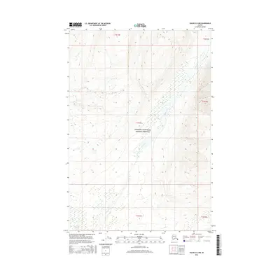
2016 Map of Valdez D-2 NW
USGS Topo · Published 2016About this map
Dadina River meanders through the heart of this landscape, its wide braided bed cutting a path through the southern reaches of the Wrangell-Saint Elias National Preserve. This 2016 survey illustrates a largely untouched wilderness within the Unorganized Borough, where the terrain is defined by the alluvial patterns of the river and the complex topography of the Wrangell Mountains. The area is divided by numerous township boundaries, including t2n r4e and t3n r4e, which provide the geometric framework for this protected Alaskan interior. For those studying the glacial and fluvial geomorphology of the region, the map details the subtle shifts in the river's course as it flows south toward its eventual confluence beyond this sheet.
Find a feature on this map
8 named features on this map. Tap any name to fly to it.
Don’t see what you’re looking for? This feature index may not catch every label — zoom into the map to look around manually.
Map Details
Editions of this 2016 Valdez D-2 NW Map
This is the sole edition of this map. No revisions or reprints were ever made.
Other maps of this area

1951 · Gulkana
USGS Topo · 1:250,000

1952 · Valdez
USGS Topo · 1:250,000

1958 · Valdez D-3
USGS Topo · 1:63,360

1959 · Valdez D-2
USGS Topo · 1:63,360
1959 · Gulkana A-2
USGS Topo · 1:63,360

1959 · Gulkana
USGS Topo · 1:250,000

1960 · Valdez
USGS Topo · 1:250,000

1965 · Gulkana
USGS Topo · 1:250,000
1996 · Valdez D-3
USGS Topo · 1:63,360
1996 · Valdez D-2
USGS Topo · 1:63,360