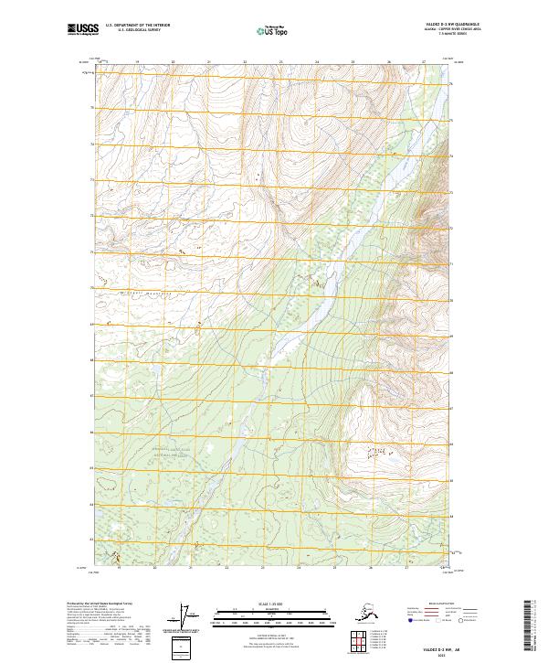
2023 Map of Valdez D-2 NW
USGS Topo · Published 2023About this map
The Dadina River carves a path through the towering Wrangell Mountains, defining the primary drainage system of this remote Alaskan interior. The landscape is split between the high-elevation protection of the Wrangell-St. Elias Wilderness to the north and the broader Wrangell-Saint Elias National Preserve spanning the southern reaches. This modern survey illustrates the sharp transition from steep, glacial-carved peaks into the river valleys below, where braided water channels navigate the base of the mountains. The absence of roads or established settlements emphasizes the character of this protected wilderness, focusing entirely on the topographic contours and the natural course of the river through several townships including t2n r4e and t1n r4e.
Find a feature on this map
10 named features on this map. Tap any name to fly to it.
Don’t see what you’re looking for? This feature index may not catch every label — zoom into the map to look around manually.
Map Details
Editions of this 2023 Valdez D-2 NW Map
This is the sole edition of this map. No revisions or reprints were ever made.
Other maps of this area

1951 · Gulkana
USGS Topo · 1:250,000

1952 · Valdez
USGS Topo · 1:250,000

1958 · Valdez D-3
USGS Topo · 1:63,360

1959 · Valdez D-2
USGS Topo · 1:63,360
1959 · Gulkana A-2
USGS Topo · 1:63,360

1959 · Gulkana
USGS Topo · 1:250,000

1960 · Valdez
USGS Topo · 1:250,000

1965 · Gulkana
USGS Topo · 1:250,000
1996 · Valdez D-3
USGS Topo · 1:63,360
1996 · Valdez D-2
USGS Topo · 1:63,360