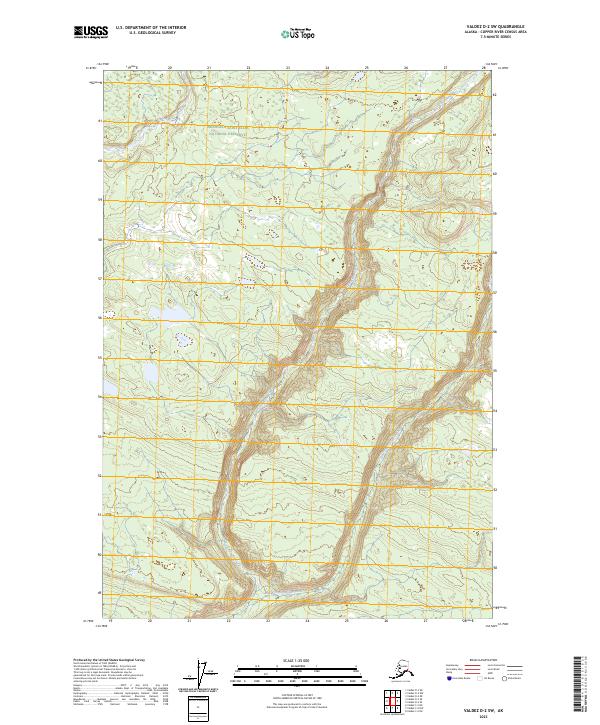
2023 Map of Valdez D-2 SW
USGS Topo · Published 2023About this map
Wrangell-Saint Elias National Preserve encompasses most of this landscape, where the glacial waters of the Dadina River and the Chetaslina River carve through high-elevation terrain. The map documents the complex drainage patterns of the region, specifically where the East Fork Chetaslina River joins the main stem amidst a network of steep contours and seasonal wetlands. This area, part of the Copper River Census Area, illustrates the wilderness character of the Alaska interior, largely untouched by permanent road infrastructure or settlements. The land division is marked by the intersections of t1n r4e, t1n r5e, t1s r4e, and t1s r5e, providing a precise look at the Public Land Survey System boundaries within the preserve.
Find a feature on this map
8 named features on this map. Tap any name to fly to it.
Don’t see what you’re looking for? This feature index may not catch every label — zoom into the map to look around manually.
Map Details
Editions of this 2023 Valdez D-2 SW Map
This is the sole edition of this map. No revisions or reprints were ever made.
Other maps of this area

1951 · Valdez C-2
USGS Topo · 1:63,360

1951 · Valdez C-3
USGS Topo · 1:63,360

1952 · Valdez
USGS Topo · 1:250,000

1953 · Valdez C-2
USGS Topo · 1:63,360

1953 · Valdez C-3
USGS Topo · 1:63,360

1958 · Valdez D-3
USGS Topo · 1:63,360

1959 · Valdez D-2
USGS Topo · 1:63,360

1960 · Valdez
USGS Topo · 1:250,000
1996 · Valdez D-3
USGS Topo · 1:63,360

1996 · Valdez C-2
USGS Topo · 1:63,360