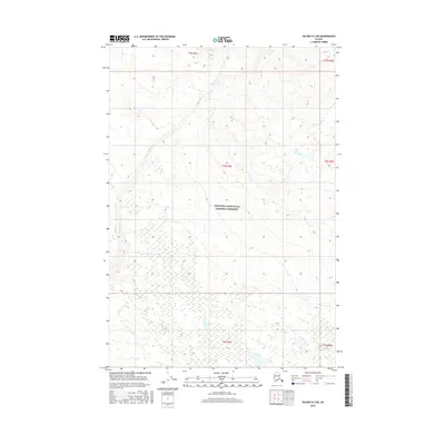
2016 Map of Valdez D-3 NE
USGS Topo · Published 2016About this map
The Nadina River flows across this northern reach of the Wrangell-Saint Elias National Preserve, illustrating the intricate braided river systems of the Alaska Interior. The landscape is defined by extensive wetlands and complex contouring that marks the transition between glacial outwash plains and rising upland terrain. This 2016 survey documents a vast, uninhabited area of public land within the Unorganized Borough, where the natural hydrology remains the primary geographic feature. The absence of roads or permanent settlements highlights the protected status of the preserve, emphasizing a region where the natural environment is preserved in its contemporary state. Researchers of Alaskana will find the detailed mapping of river channels and topography essential for understanding the physical geography of this remote preserve boundary.
Find a feature on this map
8 named features on this map. Tap any name to fly to it.
Don’t see what you’re looking for? This feature index may not catch every label — zoom into the map to look around manually.
Map Details
Editions of this 2016 Valdez D-3 NE Map
This is the sole edition of this map. No revisions or reprints were ever made.
Other maps of this area

1951 · Gulkana
USGS Topo · 1:250,000

1952 · Valdez
USGS Topo · 1:250,000

1958 · Valdez D-3
USGS Topo · 1:63,360

1959 · Valdez D-2
USGS Topo · 1:63,360
1959 · Gulkana A-2
USGS Topo · 1:63,360

1959 · Gulkana
USGS Topo · 1:250,000

1960 · Valdez
USGS Topo · 1:250,000

1965 · Gulkana
USGS Topo · 1:250,000
1996 · Valdez D-3
USGS Topo · 1:63,360
1996 · Valdez D-2
USGS Topo · 1:63,360