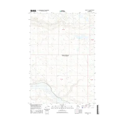
2016 Map of Valdez D-3 SE
USGS Topo · Published 2016About this map
The Wrangell-Saint Elias National Preserve encompasses the majority of this landscape, where the braided channels of the Copper River flow through the southern portion of the quadrangle. This glacial river system creates a complex network of gravel bars and shifting watercourses, characteristic of the region's dynamic hydrology. To the north, the Dadina River descends from higher elevations, fed by the surrounding topography before passing near Dadina Lake. The map illustrates a largely roadless wilderness defined by sharp elevation changes and the expansive drainage basins of these two major river systems. This 2016 survey reflects the preservation of this interior Alaskan territory, showing the relationship between the high-altitude headwaters and the broad valley floors of the Copper River basin.
Find a feature on this map
8 named features on this map. Tap any name to fly to it.
Don’t see what you’re looking for? This feature index may not catch every label — zoom into the map to look around manually.
Map Details
Editions of this 2016 Valdez D-3 SE Map
This is the sole edition of this map. No revisions or reprints were ever made.
Other maps of this area

1951 · Valdez C-2
USGS Topo · 1:63,360

1951 · Valdez C-3
USGS Topo · 1:63,360

1952 · Valdez
USGS Topo · 1:250,000

1953 · Valdez C-2
USGS Topo · 1:63,360

1953 · Valdez C-3
USGS Topo · 1:63,360

1958 · Valdez D-3
USGS Topo · 1:63,360

1959 · Valdez D-2
USGS Topo · 1:63,360

1960 · Valdez
USGS Topo · 1:250,000
1996 · Valdez D-3
USGS Topo · 1:63,360

1996 · Valdez C-2
USGS Topo · 1:63,360