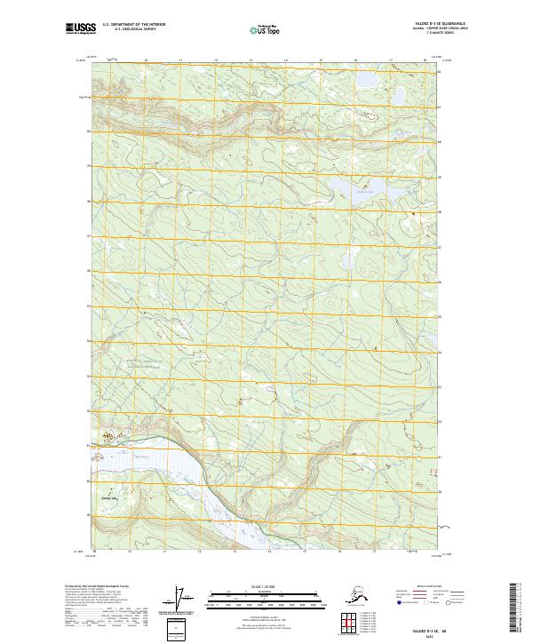
2023 Map of Valdez D-3 SE
USGS Topo · Published 2023About this map
The Copper River defines the southwestern edge of this landscape, its wide channel cutting through the Copper River Census Area. This river system has long served as a critical corridor for transport and subsistence in the region. To the north and east, the Dadina River meanders toward its confluence, draining a terrain marked by the waters of Dadina Lake. These waterways are central to the area's geography, providing natural landmarks within a vast wilderness that transitions from river bottomlands to the protected expanse of the Wrangell-Saint Elias National Preserve. Near the southern boundary, the settlement at Kenny Lake serves as a modern focal point for local residency and agriculture, established in a region where glacial history and river dynamics shape the available land. The map illustrates the division of public and protected lands, highlighting the intersection of local community development and federal conservation efforts.
Find a feature on this map
9 named features on this map. Tap any name to fly to it.
Don’t see what you’re looking for? This feature index may not catch every label — zoom into the map to look around manually.
Map Details
Editions of this 2023 Valdez D-3 SE Map
This is the sole edition of this map. No revisions or reprints were ever made.
Other maps of this area

1951 · Valdez C-2
USGS Topo · 1:63,360

1951 · Valdez C-3
USGS Topo · 1:63,360

1952 · Valdez
USGS Topo · 1:250,000

1953 · Valdez C-2
USGS Topo · 1:63,360

1953 · Valdez C-3
USGS Topo · 1:63,360

1958 · Valdez D-3
USGS Topo · 1:63,360

1959 · Valdez D-2
USGS Topo · 1:63,360

1960 · Valdez
USGS Topo · 1:250,000
1996 · Valdez D-3
USGS Topo · 1:63,360

1996 · Valdez C-2
USGS Topo · 1:63,360