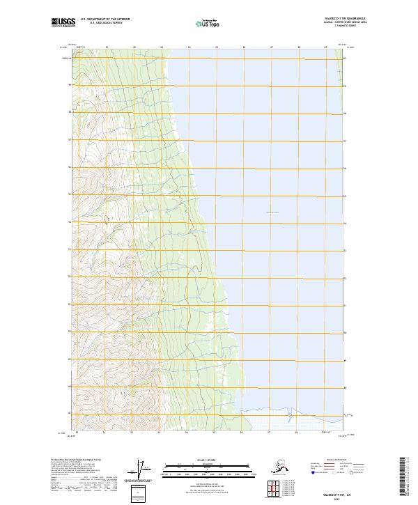
2023 Map of Valdez D-7 SW
USGS Topo · Published 2023About this map
Tazlina Lake dominates the eastern expanse of this remote Alaskan interior landscape, where the waters meet the foot of a steep mountain system. The transition from the lake shore to the rising elevations of the western half of the map is defined by closely spaced contour lines, indicating a significant and rapid gain in altitude. This topographic study reveals the natural boundaries where the massive lake system interfaces with the Copper River Census Area's wilderness. The map is primarily an examination of physical geography and hydrography, showing how the landform shapes the western reaches of the lake and the drainages that feed into it.
Find a feature on this map
5 named features on this map. Tap any name to fly to it.
Don’t see what you’re looking for? This feature index may not catch every label — zoom into the map to look around manually.
Map Details
Editions of this 2023 Valdez D-7 SW Map
This is the sole edition of this map. No revisions or reprints were ever made.
Other maps of this area

1949 · Valdez D-8
USGS Topo · 1:63,360

1949 · Valdez D-7
USGS Topo · 1:63,360

1951 · Valdez D-7
USGS Topo · 1:63,360

1952 · Valdez D-8
USGS Topo · 1:63,360

1952 · Valdez
USGS Topo · 1:250,000

1960 · Valdez C-7
USGS Topo · 1:63,360

1960 · Valdez C-8
USGS Topo · 1:63,360

1960 · Valdez
USGS Topo · 1:250,000
1993 · Valdez D-7
USGS Topo · 1:63,360
1993 · Valdez D-8
USGS Topo · 1:63,360