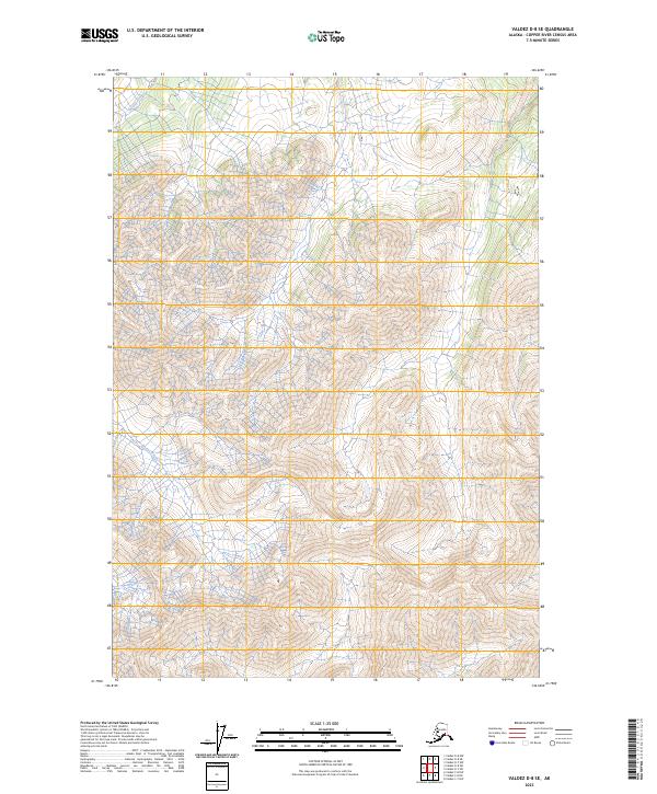
2023 Map of Valdez D-8 SE
USGS Topo · Published 2023About this map
Bottley Creek defines the lower drainage patterns of this high-elevation Alaskan terrain, carving through the southern portion of the Copper River Census Area. The topography is dominated by steep, complex contouring that reflects the dramatic elevation changes typical of the interior wilderness. Surveyed under the Public Land Survey System, the map is organized into several townships, including t1n r9w, t1n r8w, t1s r9w, and t1s r8w. The absence of developed roads or settlements highlights the unpopulated nature of this landscape, where natural watercourses and ridge lines serve as the primary landmarks for navigation and land management.
Find a feature on this map
5 named features on this map. Tap any name to fly to it.
Don’t see what you’re looking for? This feature index may not catch every label — zoom into the map to look around manually.
Map Details
Editions of this 2023 Valdez D-8 SE Map
This is the sole edition of this map. No revisions or reprints were ever made.
Other maps of this area

1949 · Valdez D-8
USGS Topo · 1:63,360

1949 · Valdez D-7
USGS Topo · 1:63,360

1951 · Valdez D-7
USGS Topo · 1:63,360

1952 · Valdez D-8
USGS Topo · 1:63,360

1952 · Valdez
USGS Topo · 1:250,000

1960 · Valdez C-7
USGS Topo · 1:63,360

1960 · Valdez C-8
USGS Topo · 1:63,360

1960 · Valdez
USGS Topo · 1:250,000
1993 · Valdez D-7
USGS Topo · 1:63,360
1993 · Valdez D-8
USGS Topo · 1:63,360