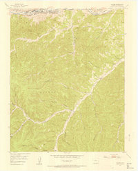
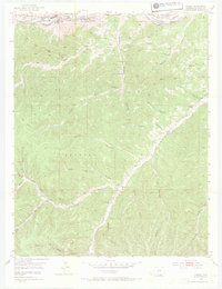
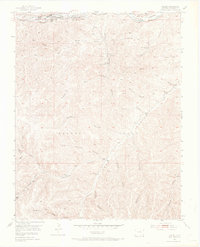
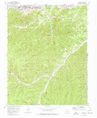
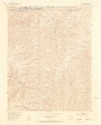
1951 Map of Valdez
USGS Topo · Published 1953About this map
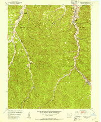
Industrial activity along the Purgatoire River defines this portion of the Maxwell Grant in the early 1950s. The coal-mining economy is clearly visible through the extensive infrastructure of the Frederick Mine, which includes airshafts, pipe drains, and several inactive shafts spread across the canyon slopes. Near the settlement of Segundo, the presence of Coke Ovens along the Colorado and Wyoming railroad tracks illustrates the local transformation of coal for the steel industry.
Find a feature on this map
37 named features on this map. Tap any name to fly to it.
Don’t see what you’re looking for? This feature index may not catch every label — zoom into the map to look around manually.
Map Details
Editions of this 1951 Valdez Map
5 editions found
Other maps of this area

1891 · Spanish Peaks
USGS Topo · 1:125,000

1893 · Spanish Peaks
USGS Topo · 1:125,000

1895 · Spanish Peaks
USGS Topo · 1:125,000

1897 · Spanish Peaks
USGS Topo · 1:125,000

1900 · Spanish Peaks
USGS Topo · 1:125,000
1915 · Brilliant
USGS Topo · 1:62,500
1951 · Trinidad
USGS Topo · 1:24,000
1951 · Valdez
USGS Topo · 1:24,000
1951 · Madrid
USGS Topo · 1:24,000
1951 · Starkville
USGS Topo · 1:24,000