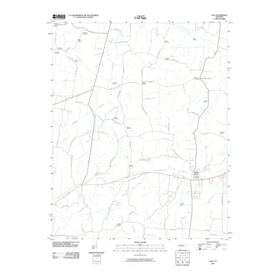
2010 Map of Vale
USGS Topo · Published 2010About this map
Hollow Rock serves as the primary focal point of this Carroll County landscape, situated where Hollow Rock Branch meets the transport corridors running east-west across the terrain. The area is defined by a high density of burial sites and family-named landmarks, such as Abernathy Cemetery, Massey Cemetery, and Harder Cemetery, indicating deep ancestral roots and long-established homesteads. Small community hubs like Pea Ridge and Barren Spring are connected by a network of rural routes, including Tater House Rd and Barren Springs Rd. The drainage patterns of Little Beaver Creek and Crooked Creek shape the local topography, while locations like Coopers Spur suggest the importance of early rail or transit connections in this part of Tennessee. This survey provides a clear view of the rural fabric before modern development further altered the distribution of local schools and churches.
Find a feature on this map
64 named features on this map. Tap any name to fly to it.
Don’t see what you’re looking for? This feature index may not catch every label — zoom into the map to look around manually.
Map Details
Editions of this 2010 Vale Map
This is the sole edition of this map. No revisions or reprints were ever made.
Other maps of this area

1936 · Seventeen Creek
USGS Topo · 1:24,000

1936 · Mansfield
USGS Topo · 1:24,000

1936 · Vale
USGS Topo · 1:24,000

1936 · Center Ridge
USGS Topo · 1:24,000

1936 · Bruceton
USGS Topo · 1:24,000

1936 · Buena Vista
USGS Topo · 1:24,000

1936 · Manleyville
USGS Topo · 1:24,000

1940 · Manleyville
USGS Topo · 1:24,000

1941 · Manleyville
USGS Topo · 1:24,000

1950 · Palmer Shelter
USGS Topo · 1:24,000