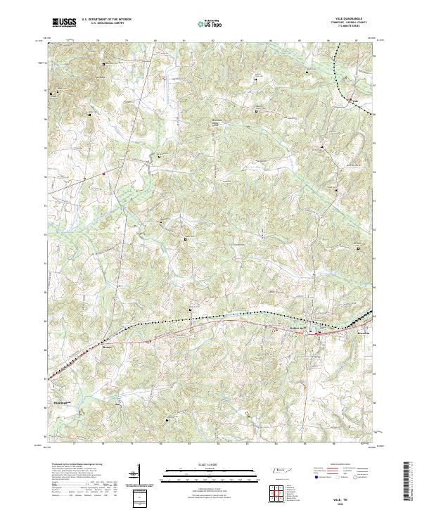
2022 Map of Vale
USGS Topo · Published 2022About this map
Hollow Rock and Bruceton serve as the primary hubs in this part of Carroll County, where the CSX railroad corridor dictates the local geography. The landscape is defined by the Tennessee Valley Divide, a natural ridge line that separates the drainage basins of numerous creeks. Historically significant family burial grounds such as Abernathy Cem, Massey Family Cem, and Mebane Cem are scattered across the terrain, offering a clear record of early settlement patterns and genealogical history. The northern reaches are characterized by Pea Ridge and the waters of Vale Pond, while the southern portion transition toward the larger community of Huntingdon. Engineering efforts to manage the landscape are evident in the Crooked Cr Drainage Canal, which cuts through the western section to control the flow of Carver Cr and Dry Fork.
Find a feature on this map
107 named features on this map. Tap any name to fly to it.
Don’t see what you’re looking for? This feature index may not catch every label — zoom into the map to look around manually.
Map Details
Editions of this 2022 Vale Map
This is the sole edition of this map. No revisions or reprints were ever made.
Other maps of this area

1936 · Seventeen Creek
USGS Topo · 1:24,000

1936 · Mansfield
USGS Topo · 1:24,000

1936 · Vale
USGS Topo · 1:24,000

1936 · Center Ridge
USGS Topo · 1:24,000

1936 · Bruceton
USGS Topo · 1:24,000

1936 · Buena Vista
USGS Topo · 1:24,000

1936 · Manleyville
USGS Topo · 1:24,000

1940 · Manleyville
USGS Topo · 1:24,000

1941 · Manleyville
USGS Topo · 1:24,000

1950 · Palmer Shelter
USGS Topo · 1:24,000