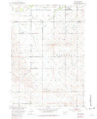
1951 Map of Vale
USGS Topo · Published 1982About this map
Whitewood Creek and Ninemile Creek carve through the landscape of the Butte and Meade County border in this mid-century survey. The small settlement of Vale serves as the local hub, situated near the Chicago and North Western rail line and the Vale Cemetery. This area represents a post-war ranching and agricultural community where education was localized at sites like Farview School and Cottonwood School, while the Riggs School (Abandoned) suggests early shifts in the rural population.
Find a feature on this map
16 named features on this map. Tap any name to fly to it.
Don’t see what you’re looking for? This feature index may not catch every label — zoom into the map to look around manually.
Map Details
Editions of this 1951 Vale Map
3 editions found

Other maps of this area

1893 · Rapid
USGS Topo · 1:125,000

1894 · Deadwood
USGS Topo · 1:125,000

1898 · Rapid
USGS Topo · 1:125,000

1899 · Sturgis
USGS Topo · 1:62,500

1901 · Deadwood
USGS Topo · 1:125,000

1903 · Rapid
USGS Topo · 1:125,000

1905 · Saint Onge
USGS Topo · 1:62,500

1906 · Vale
USGS Topo · 1:62,500

1907 · Belle Fourche
USGS Topo · 1:125,000

1913 · Newell
USGS Topo · 1:125,000