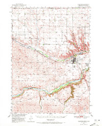
1957 Map of Valentine
USGS Topo · Published 1978About this map
The Sand Hills dominate this mid-century landscape, a vast region of stabilized dunes where water and rail networks defined the isolated ranching communities. Two primary rail corridors anchor the territory: the Chicago and North Western running through Valentine and Crookston in the north, and the Burlington Northern serving Mullen and Hyannis in the south. The hydrological pattern is striking, with the Niobrara River and Snake River carving distinct valleys through the hills, while the Merritt Reservoir and the numerous small lakes of the Valentine National Wildlife Refuge provide critical water sources in an otherwise arid terrain.
Find a feature on this map
42 named features on this map. Tap any name to fly to it.
Don’t see what you’re looking for? This feature index may not catch every label — zoom into the map to look around manually.
Map Details
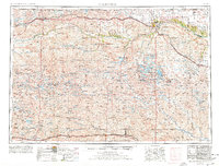
Editions of this 1957 Valentine Map
3 editions found

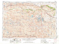
Historical Maps of Valentine Through Time
4 maps found