1968 Map of Valentine
USGS Topo · Published 1980About this map
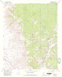
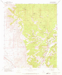
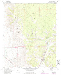
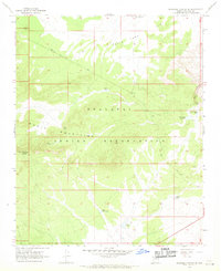
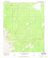
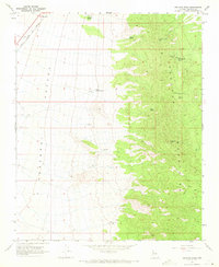
Valentine and Hackberry sit along the corridor of the Atchison Topeka and Santa Fe railroad, anchoring this high-desert landscape during the late 1960s. The terrain is dramatically defined by the Grand Wash Cliffs, which separate the lower Valley floor from the high-elevation plateaus to the east. Water management is the primary industrial footprint visible on this sheet, evidenced by an extensive network of sources such as Stone Corral Spring, Crozier Spring, and Valentine PO Spring, many of which are linked to the Truxton Aqueduct or the regional Pipeline. Within the Hualapai Indian Reservation, the map records the infrastructure of the Valentine PO and localized extraction sites like the Mine and Borrow Pit, illustrating how the rail-and-water economy sustained these small Mohave County outposts.
Find a feature on this map
32 named features on this map. Tap any name to fly to it.
Don’t see what you’re looking for? This feature index may not catch every label — zoom into the map to look around manually.
Map Details
Editions of this 1968 Valentine Map
3 editions found
Other maps of this area

1886 · Diamond Creek
USGS Topo · 1:250,000

1892 · Diamond Creek
USGS Topo · 1:250,000

1948 · Williams
USGS Topo · 1:250,000

1954 · Williams
USGS Topo · 1:250,000

1956 · Williams
USGS Topo · 1:250,000

1960 · Williams
USGS Topo · 1:250,000

1961 · Williams
USGS Topo · 1:250,000
1967 · Milkweed Canyon SE
USGS Topo · 1:24,000
1967 · Milkweed Canyon SW
USGS Topo · 1:24,000
1968 · Peacock Peak
USGS Topo · 1:24,000