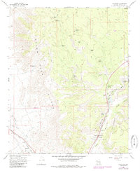
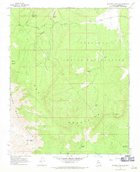
1968 Map of Valentine
USGS Topo · Published 1985About this map
The Hualapai Indian Reservation occupies much of this Mohave County landscape, where the dramatic Grand Wash Cliffs separate the high plateau from the lower Hualapai Valley. The settlement of Valentine serves as a focal point along the Atchison Topeka and Santa Fe railroad, featuring the local Valentine PO and nearby Valentine PO Spring. The map documents a critical transportation and utility corridor, where the historic route of 66 winds through Truxton Canyon alongside a major Pipeline and Aqueduct. Water management is central to the area's survival, evidenced by numerous named tanks and springs like Crozier Canyon Spring Water Tank and Grapevine Spring. Further south, the map captures the outskirts of Hackberry and the branching drainage of Truxton Wash, illustrating the rugged infrastructure of the Arizona high desert in the late 1960s.
Find a feature on this map
33 named features on this map. Tap any name to fly to it.
Don’t see what you’re looking for? This feature index may not catch every label — zoom into the map to look around manually.
Map Details
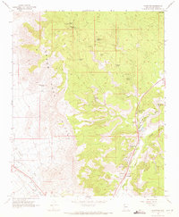
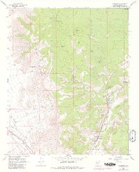
Editions of this 1968 Valentine Map
3 editions found
Other maps of this area

1886 · Diamond Creek
USGS Topo · 1:250,000

1892 · Diamond Creek
USGS Topo · 1:250,000

1948 · Williams
USGS Topo · 1:250,000

1954 · Williams
USGS Topo · 1:250,000

1956 · Williams
USGS Topo · 1:250,000

1960 · Williams
USGS Topo · 1:250,000

1961 · Williams
USGS Topo · 1:250,000
1967 · Milkweed Canyon SE
USGS Topo · 1:24,000
1967 · Milkweed Canyon SW
USGS Topo · 1:24,000
1968 · Peacock Peak
USGS Topo · 1:24,000